
How the Riverside Street Directory Starts
Riverside's address trail is a set of linked checks. Ownership is a property question, occupancy another, and an old directory only a publication snapshot. Start with the address in the assessor search. Copy the APN. Move from map to deed, then to older household evidence. Each handoff preserves a key when a name, mailing line, or street label changes.
Use the address first, then let each record answer its own narrow question. RivCoView supplies parcel facts and mapped context. Riverside County Assessor-County Clerk-Recorder (ACR) public-service computers bridge the online search to an owner. The recorder translates that name into a deed chain, while voter material and reverse directories add limited household clues.
- Enter the street number and street name in RivCoView, or use the APN when it is already known. Note the assessment, tax, sales, permit, census, and school panels.
- Open Map My County, select the parcel, and click adjacent polygons to collect nearby APNs and jurisdiction layers.
- At an ACR public-service computer, connect the address or APN to the public owner record and keep the situs and mailing lines separate.
- Search the current owner as a grantee in the recorder index, read the grantor and legal description, and repeat backward when an older chain matters.
- Use voter material only through an authorized route, then check library reverse or criss-cross directories for a past household snapshot.
Riverside Address Records at a Glance
Each address-keyed source reveals a different part of a Riverside street. A coverage table keeps a parcel clue from being mistaken for proof of occupancy, and it shows where an online result ends.
| Record Set | Keeper | Street Clue | Access |
|---|---|---|---|
| Assessment and tax roll | ACR Assessor | APN, situs, values, sales, characteristics | RivCoView online; owner at ACR computers |
| Parcel GIS | County GIS and ACR | Adjacent APNs, shape, jurisdiction, layers | Map My County and RivCoView |
| Recorded deeds | ACR Recorder | Grantor, grantee, legal parcel, transfer date | Online index; office, mail, or ordered copies |
| Voter information | California SOS and Registrar | Voter residence only through permitted access | Own-record lookup or approved file purpose |
| Permits and code cases | City Building & Safety or county TLMA | Applicant, contractor, work, dates, notices | Address portal or file request |
| Reverse directories | Libraries, museums, and collections | Listed occupant or phone at publication | Local-history desk, microfilm, or catalog |
The APN ties the assessment roll to mapped geometry, permits, tax records, and a deed's legal description. A name becomes the bridge into the recorder index. Voter material and reverse directories sit beside that chain, not inside it. They suggest a household at one point in time, not everyone at an address.
Note: A parcel result can establish a land or transfer clue without establishing every person who uses the address.
Inside RivCoView's Riverside Street Search
RivCoView accepts a street number and street name or an APN. Its panels bring assessment and tax data, sales, permits, census information, and schools into one parcel view. Use the address when a resident's name is unknown; use the APN when an old address has several spellings.
| Field or control | Type | Required | Format and use |
|---|---|---|---|
| Property Address | Text | Alternative | Street number and street name only; omit city or suffix if needed |
| Assessor Parcel Number | Text | Alternative | APN; hyphens may be normalized |
| Map search | Pan, zoom, click | No | Select the mapped parcel and nearby parcels |
| Layers | Map control | No | Parcels, boundaries, assessment/tax, sales, permits, census, and schools as available |
The RivCoView property search shows the address and APN path that supports a street-by-street lookup.
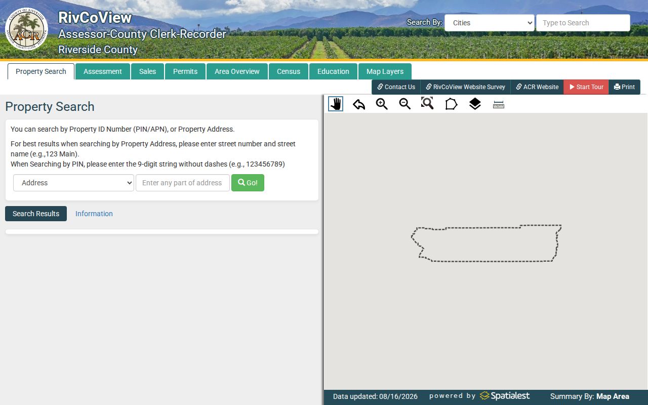
The online card is a parcel research aid. It does not display the owner identity online, so the next step is an ACR office computer or a separate recorded-document search.
Reading Riverside Street Parcels Side by Side
Map My County turns a Riverside address into a block view. Search the address or APN, zoom to parcel outlines, identify the subject polygon, and click parcels that touch it or lie across the street. Capture each APN.
Layers can add city or unincorporated boundaries, zoning, flood areas, supervisorial districts, and service districts. Pan and zoom follow a street; measuring shows distance, not a legal boundary. A tract map or survey controls boundaries. GIS helps find the next APN and custodian.
Riverside Street Terms Before You Search
Four terms prevent mistakes in an address search. They describe different keys and kinds of evidence, so retain the term used by the record keeper.
- APN
- An Assessor Parcel Number identifies the assessment parcel. It is a stable research key, not a code for the people who live there.
- Situs address
- The situs is the physical location of the land or building. It may differ from the address used for tax mail.
- Legal description
- A deed description ties land to a tract, lot, block, map, or metes-and-bounds description. It can carry an older identity through a street-name change.
- Mailing address
- The mailing line receives assessment notices. It may belong to an owner, business, agent, or other address and does not prove occupancy.
Keep situs, mailing, APN, and legal-description fields separate when comparing a Riverside street record across years.
From Riverside Street APNs to Deed Chains
Recorder records are keyed by parties, document types, dates, and legal descriptions, not by a reliable street browse. With an APN and owner clue, use the ACR menu for Name, Document Number, Document Type, Map Type and Book/Page, or Advanced Search. Individual names use Last First MI. Exact Match keeps order; Wildcard broadens it.
The ACR official-record search modes show the available routes from an address clue to a recorded instrument.
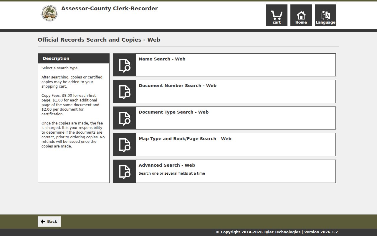
Process: address APN and legal description current owner at an ACR office grantee deed grantor earlier deed and parcel description.
A grantor transfers an interest and a grantee receives it. Read each legal description, then carry the tract, lot, book, and page forward. A deed proves participation in a transaction, not that the party still lives at the situs.
The Riverside Street Owner Access Divide
Riverside's Assessor makes the January 1 ownership list public but does not display ownership online. RivCoView returns parcel facts from an address or APN; ownership is available at public-service-office computers. That boundary matters because opening a map does not expose the person attached to a parcel.
The Riverside ACR assessor-services page explains the office route for public property records.
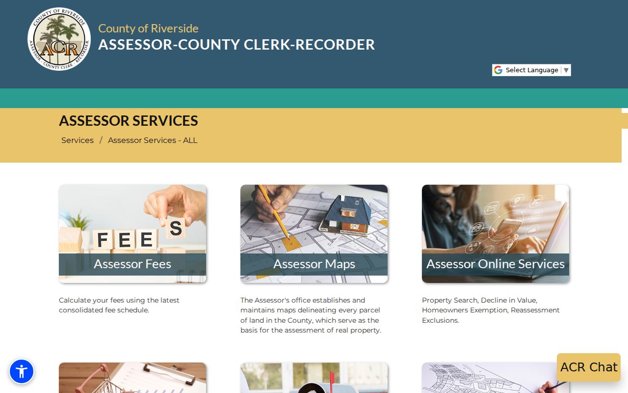
Use the office terminal when an owner name is needed. Record whether the result is an owner, mailing line, or parcel characteristic. An exemption can support an owner-occupancy inference, but it is not proof of who is present today.
Note: An owner name at the ACR counter is a property record, not a current-resident finding.
Riverside Street Copy and Mail Options
The ACR recorder index is free to search, while an image or certified copy follows an order path. Online users select the record, provide shipping information, pay, and receive mailed fulfillment. ACR states an average online processing time of 48 hours. It lists $8 for the first copy page, $1 for each added page, $2 per document for certification, and a 2.15% online card fee.
The ACR record-copy instructions set out online, office, and mail access for recorded documents.
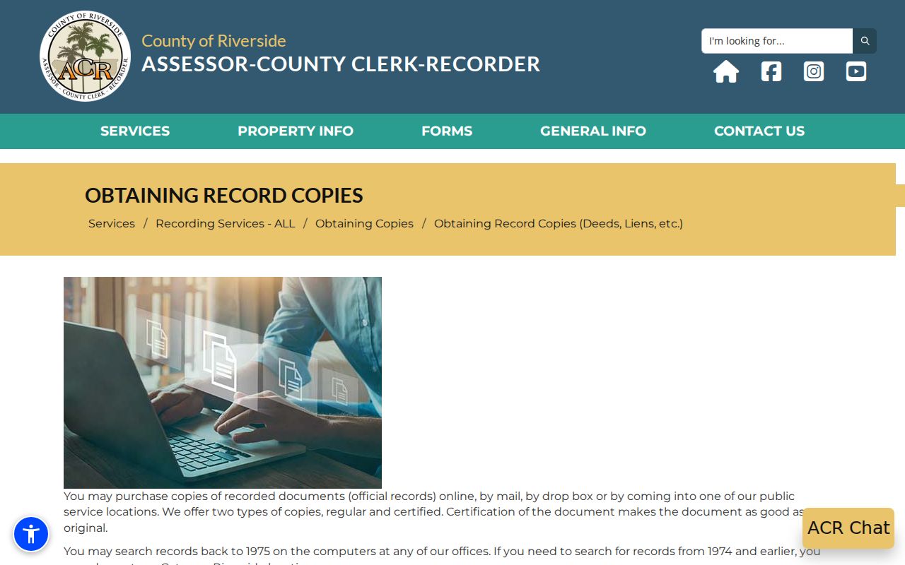
For office service, build the order, choose “In Office,” retain the SST number, schedule an appointment, and bring cash, check, money order, or card. Ordinary orders are generally same-day unless older research takes longer.
Mail requests should name the document type or title, full parties, estimated date, and APN when available. For a pre-1976 document without a number, staff limit a no-number search to two years after the estimated year. An NTE check works when page count is unknown.
Riverside Street Permits and Code Cases
Permit custody follows jurisdiction. An incorporated city uses its Building & Safety department; an unincorporated parcel uses Riverside County TLMA Building & Safety. A street name alone is not enough when a mailing city and legal jurisdiction diverge. Start with the parcel map, then use the correct address or APN portal and request an archived file when the online result is thin.
Address research can connect a permit or code record to a parcel without turning an applicant name into proof of occupancy. A result may show record number, type, address, work description, applied, issued, or final dates, status, applicant, or contractor. Plans and personal contact details may require a file request, and complaint information may be withheld.
- City Building & Safety: permits for property inside an incorporated city, with that city's own portal or records counter.
- County TLMA Building & Safety: permits for unincorporated Riverside County land and the county file-request route.
- Code enforcement: case numbers, parcel, notices, and responsible-party information where disclosure is allowed.
Riverside Street Geography Crosses Postal Lines
Riverside County has 28 incorporated cities plus broad unincorporated, desert, mountain, tribal, and agricultural areas. Postal city, incorporated city, and county jurisdiction can point to different places. A Corona label can reach Temescal Valley, Rubidoux now fits within Jurupa Valley, and Sun City is within Menifee. Those differences determine the office holding a permit, map layer, or code file.
For a records request, preserve the USPS address, then use county GIS to identify the parcel and jurisdiction. Name the actual custodian rather than sending a request to the postal city by habit. A Riverside street directory is more reliable when postal, municipal, and county labels stay side by side.
When Riverside Street Names Change
Riverside Public Works maintains an index of street-name changes, and the City of Riverside property-research materials pair that index with original tract maps. The index matters when an old household appears to vanish from a modern address search. Annexation, rural-route conversion, directional prefixes, duplicate names, and E911 readdressing can change the text while the parcel remains the same.
For family or house research, search both street labels, then carry the APN, tract, lot, and legal description between results. Inside Riverside city, begin with Public Works; elsewhere, ask the city counter or TLMA which record replaced the old line. The City of Riverside property-research guide identifies the street-name index and related maps.
Note: Keep the date and source beside every old street label so later readers can follow the address change.
Reverse Directories Along Riverside Streets
Reverse or criss-cross directories move from a street address to a listed occupant; alphabetical directories move from surname to address. The strongest documented shelf sits with the Riverside Public Library Local History Resource Center, Museum of Riverside, Riverside County Library branches, and UC Riverside Special Collections. Exact runs are not published in one complete online list, so ask the local-history desk to confirm a volume.
A directory entry may include a surname, given name or initial, spouse, residence address, and marks such as h for home or r for rooms or resides. Reverse pages can include a phone. Read the volume's abbreviation key. A directory captures a publication-cycle snapshot, not every adult or child at an address. Pair it with a census point, deed, permit, newspaper, obituary, or probate record when a past household matters.
For the historical collection itself, the Riverside Directory Book page keeps the shelf and reading method separate from current address-keyed records.
Crossing Riverside's Recorder Records Divide
The online recorder document index begins January 1, 1974. ACR's clerk-document index begins with county formation on January 1, 1893, but those are different streams. Office computers search records back to 1975, while 1974 and earlier recorder research moves to older indexes and books at Gateway Riverside. If an online name search is blank, check spelling, name order, document type, and date range first.
The ACR advanced document search shows the coverage notice and expanded fields for exact or wildcard name work.
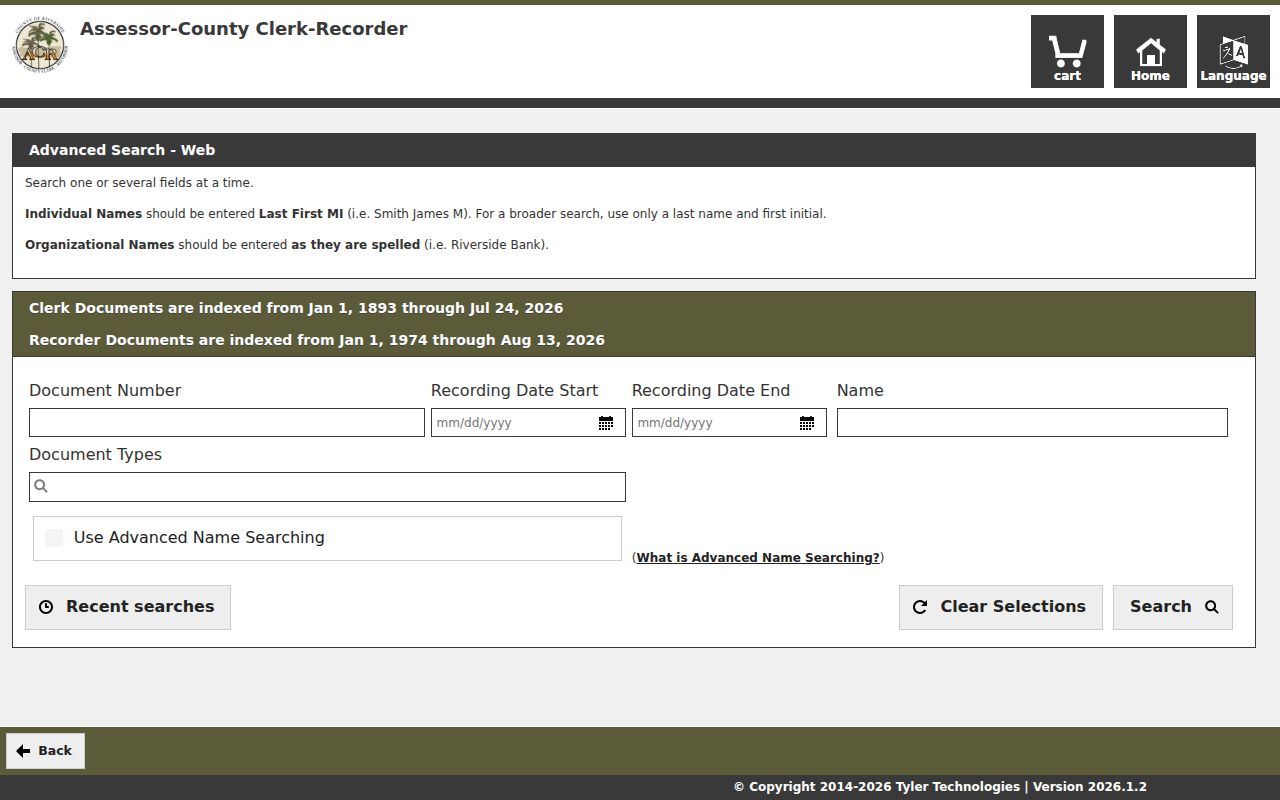
Riverside County was created from portions of San Bernardino and San Diego Counties. A pre-county deed, court event, or vital clue may sit in a predecessor index. The 1974 cutoff is an online access line, not the start of Riverside's record history.
Note: Gateway becomes the next access point when the online recorder boundary ends for an older Riverside parcel.
Limits of the Riverside Street Directory
Address records do not create an all-resident list. DMV address data is restricted under the federal DPPA, utility and delivery customer files are not public street rolls, and unlisted household members are not reliably indexed. Ownership is not occupancy. A mailing address can belong to an owner, business, or agent, while a permit applicant can be a contractor rather than a resident.
California voter information is not casual street browsing. My Voter Status is an identity-gated self lookup using first name, last name, date of birth, and a California driver-license or ID number, or the last four digits of an SSN as directed. Broader file access is limited by Elections Code section 2194 to election, scholarly, journalistic, political, or governmental purposes. A voter can also use the Registrar or Secretary of State route to correct their own record.
Lawful personal use. Use Riverside address records for family history, property research, civic records, or reconnecting. Do not assemble a street roster to target, stalk, harass, or intimidate any person. Participants in California's Safe at Home program may not appear at their actual address.